
Every year, a friend of mine at work organizes a hike up one of Colorado’s 14ers (the name for the 54 peaks in the state over 14,000 feet high). This year the plan was to climb Quandary Peak, but a forest fire near Breckenridge made things a little iffy. Instead, she decided we would climb Mount Evans. I thought this was a bit funny since there’s a perfectly serviceable road, the Mount Evans Scenic Byway, that goes to within 120 feet of the summit. It is, in fact, the highest paved road in North America.
I knew all along I was going to go, but I was a bit worried because I’ve been dealing with a lot of dizziness on the other, lower-elevation climbs I’ve done. I didn’t want to make a fool of myself or become high-maintenance.
We left Monument at 4:30 am. I rode with four ladies. We had a some great views of the sunrise as we headed north through Denver.

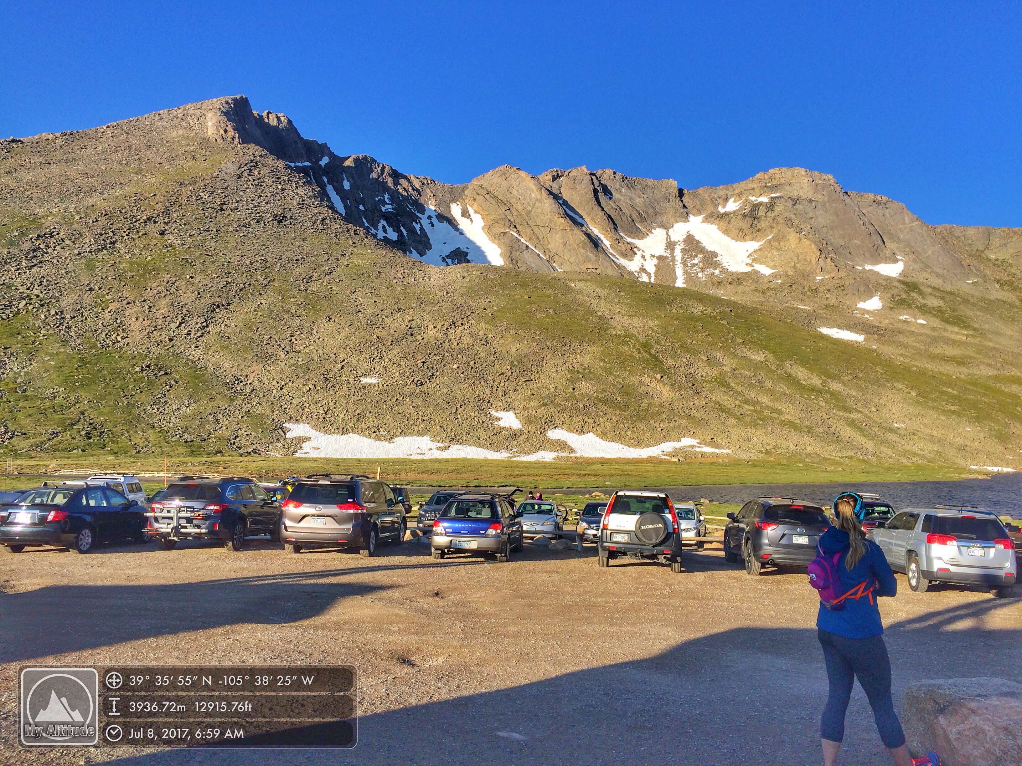
We drove up the Mount Evans Scenic Byway to Summit Lake, at 12,850 feet. That means that our elevation gain to the top would be 1,650 feet. According to some, to make an official climb, you have to gain at least 3,000 feet of elevation, but most just say you have to begin at an established trailhead, which we were doing.
In the parking lot, we met the rest of the climbers.
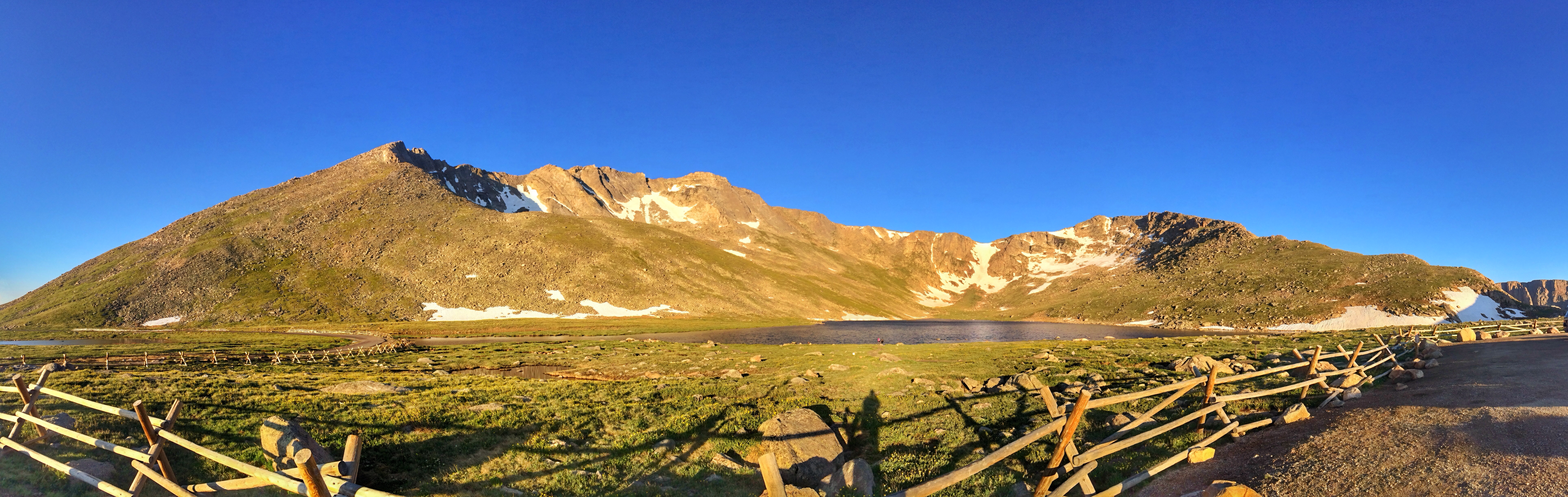
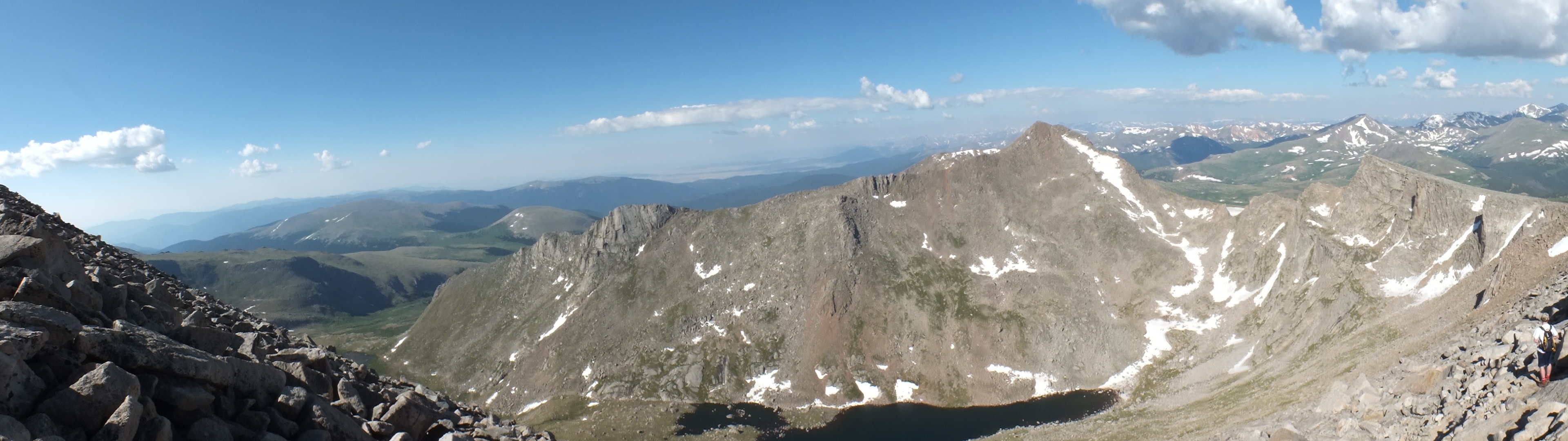
The summit is the point on the left. Our trail would lead out to the right, climb the ridge and then circle the Summit Lake basin.
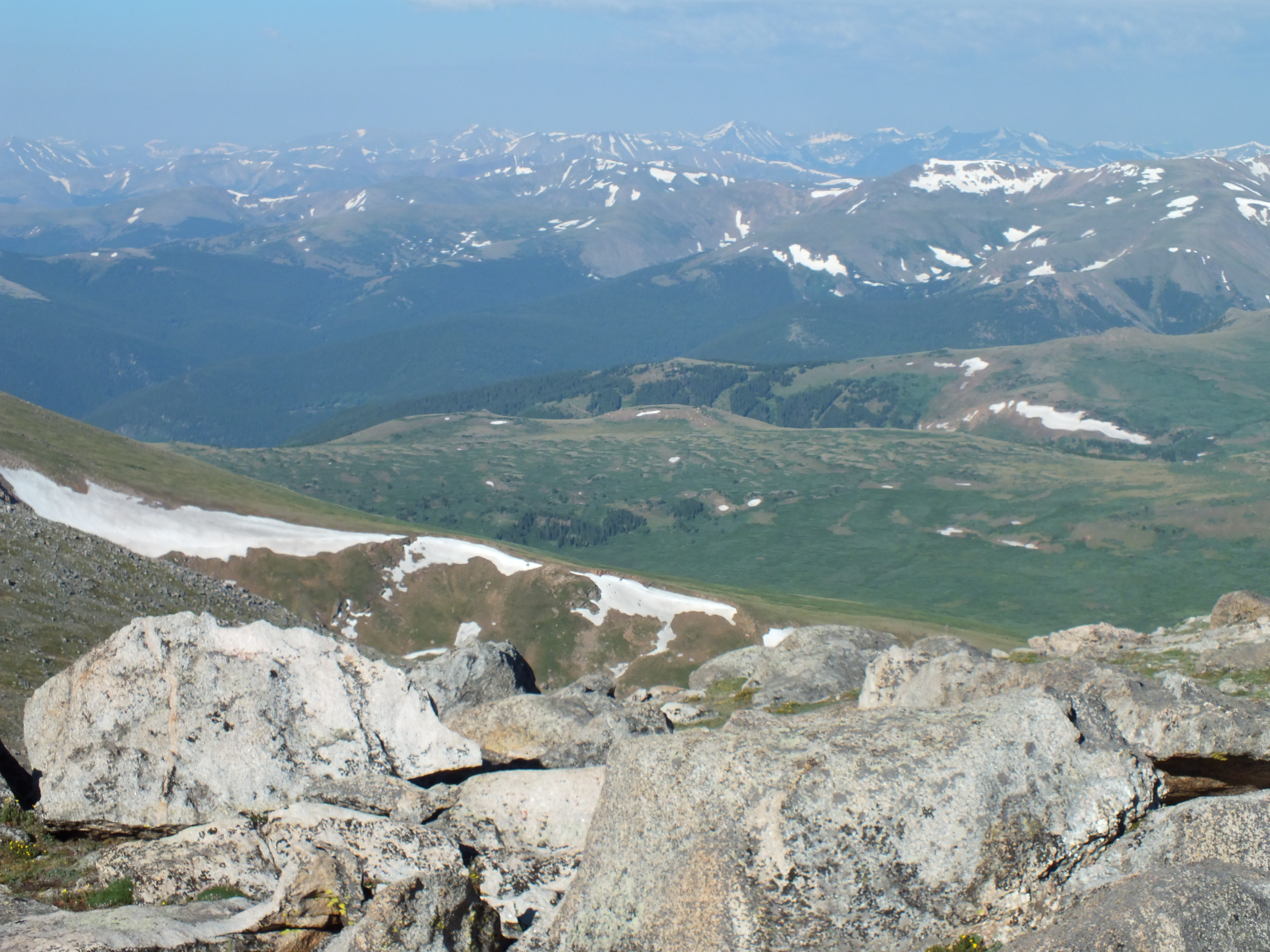
The Chicago Lakes as seen from the trail shortly after we started out. Mount Evans is the highest point in a sub-range of mountains called the Chicago Peaks.
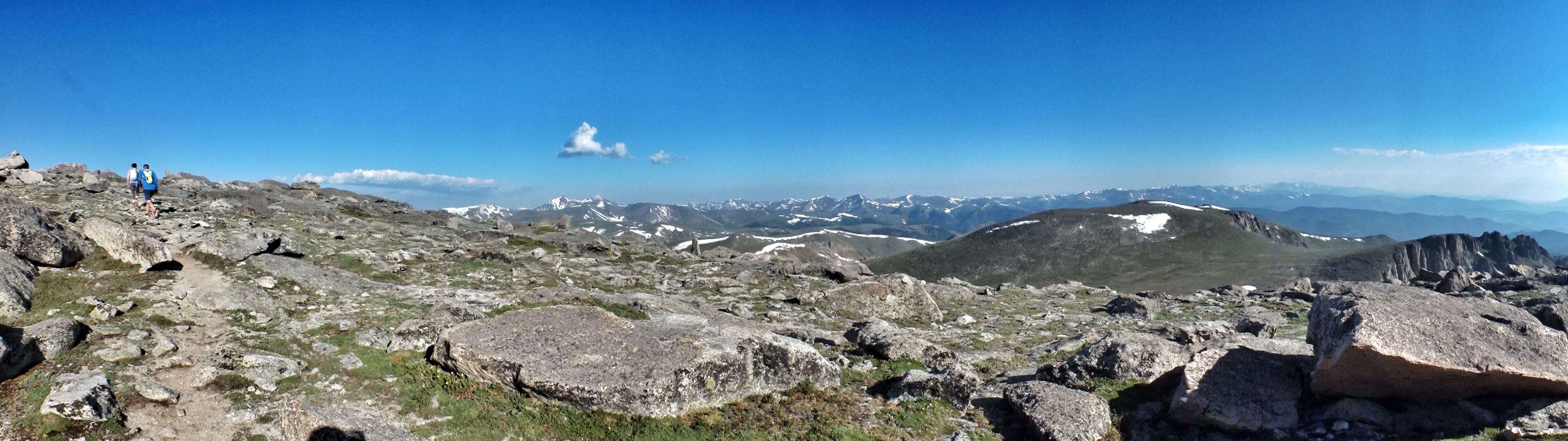
On previous hikes with my friend, she’d impressed upon me that the best way to climb was to go slowly and keep moving. I determined to use that strategy on Mount Evans, and except for occasional stops to drink water, look at scenery, or take photos, that’s pretty much what I did. This meant that I soon was out ahead of everyone except for two who took off into the distance and disappeared. There was a group of people I didn’t know which consisted of two guys, three girls, and a dog who were younger and faster, but also took more breaks. I leapfrogged with them many times all the way to the top, but otherwise was on my own much of the way.
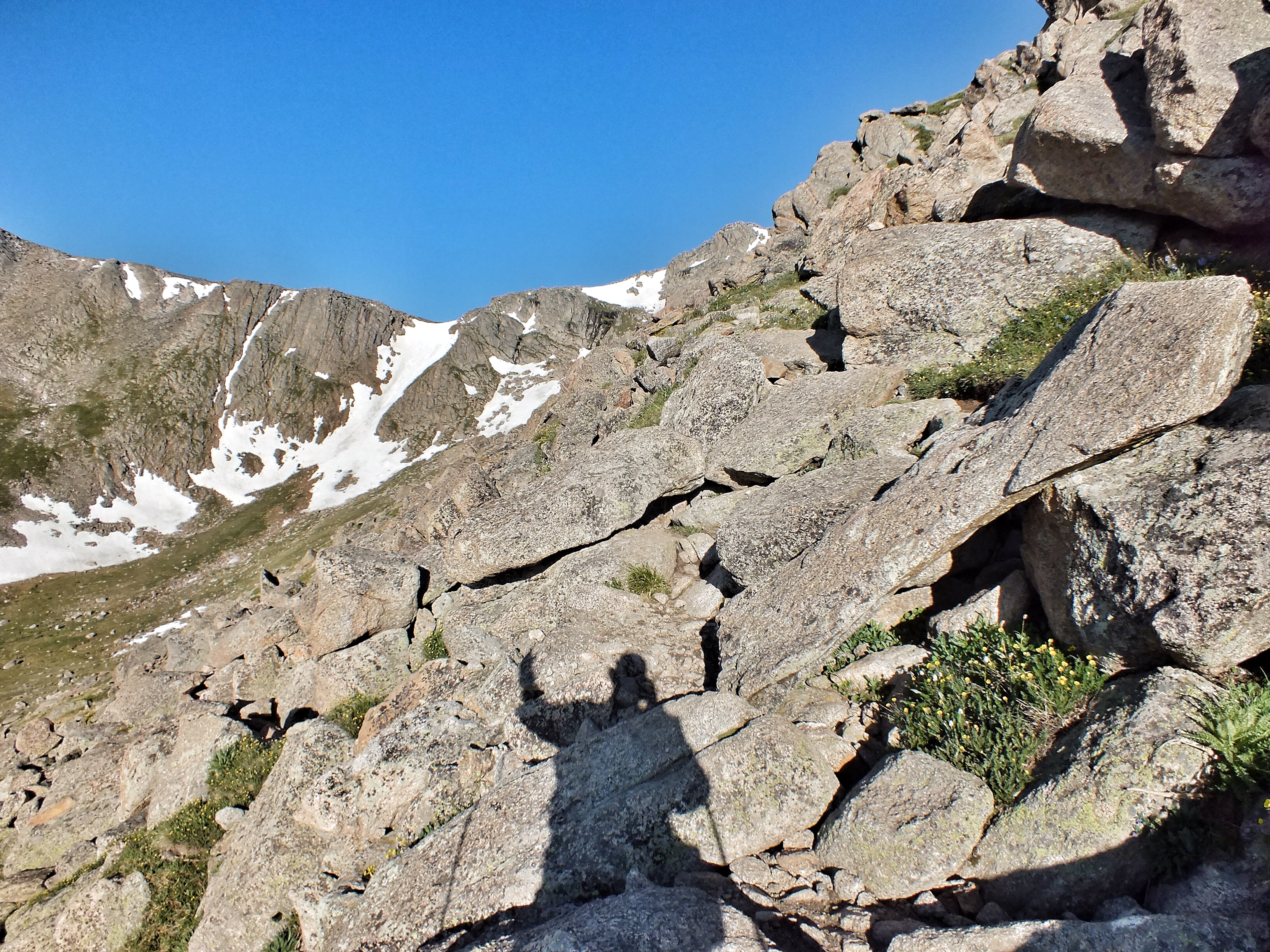
Here’s the group on the first stretch. You can just see me disappearing over the ridge at top.

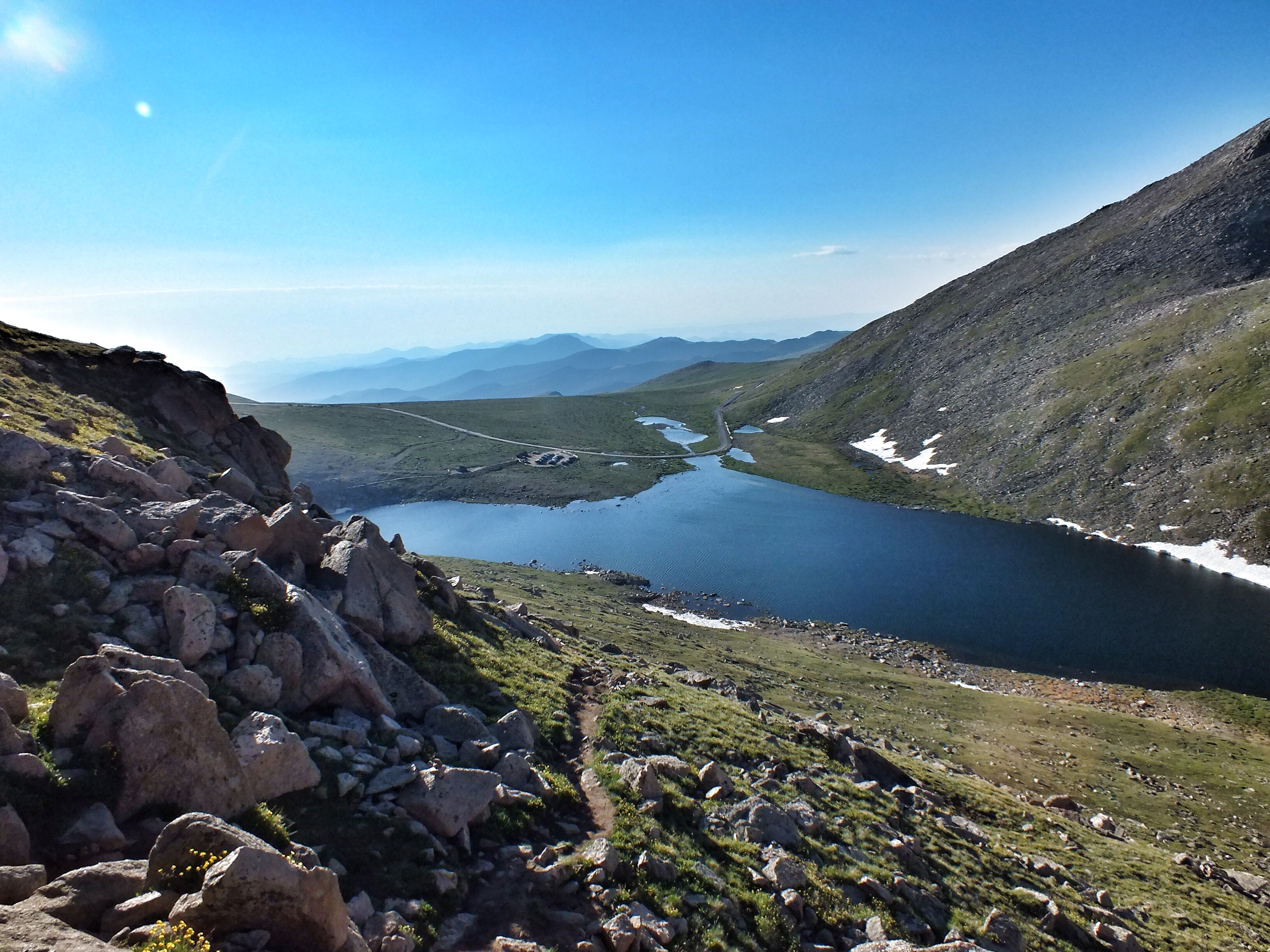
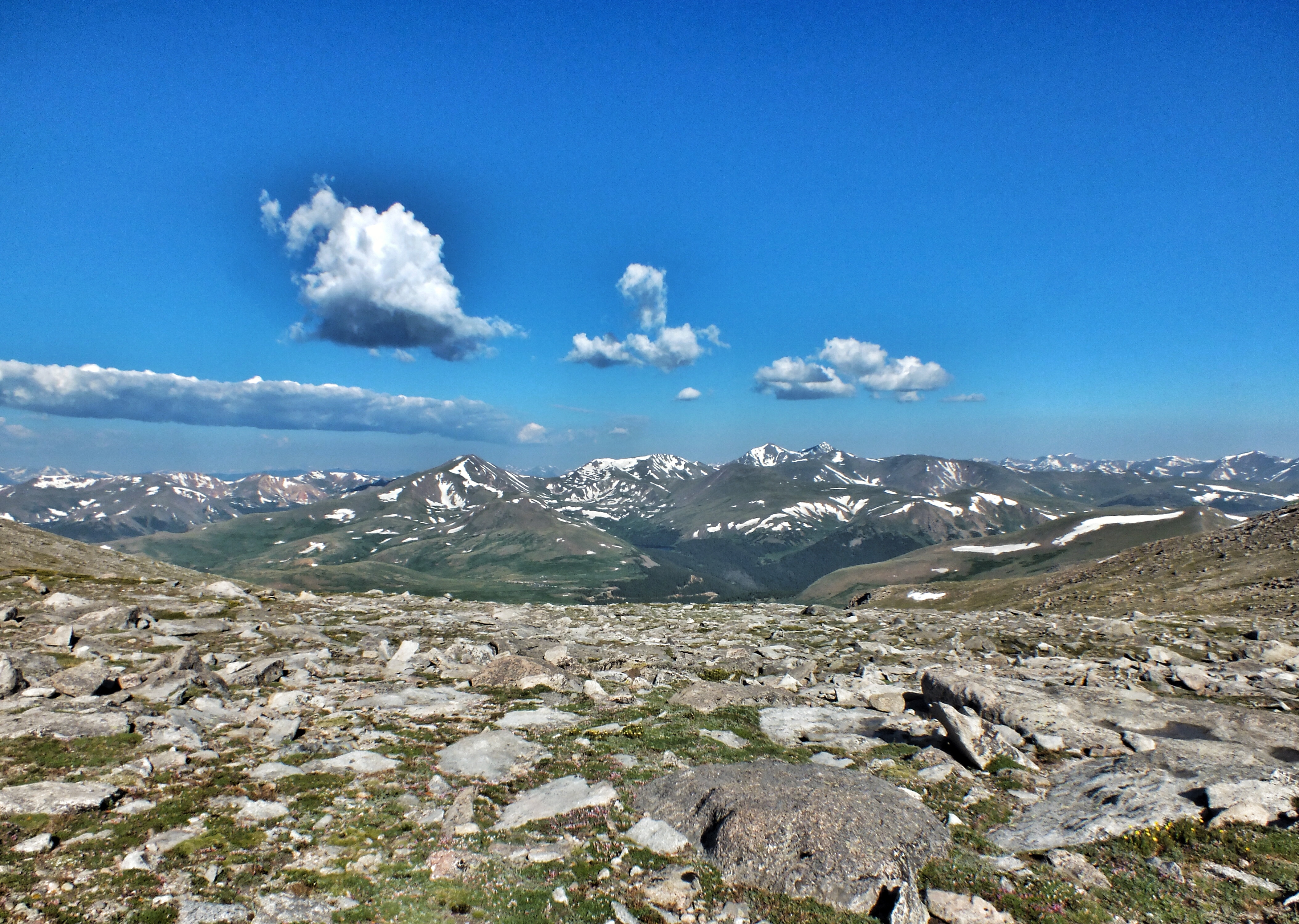
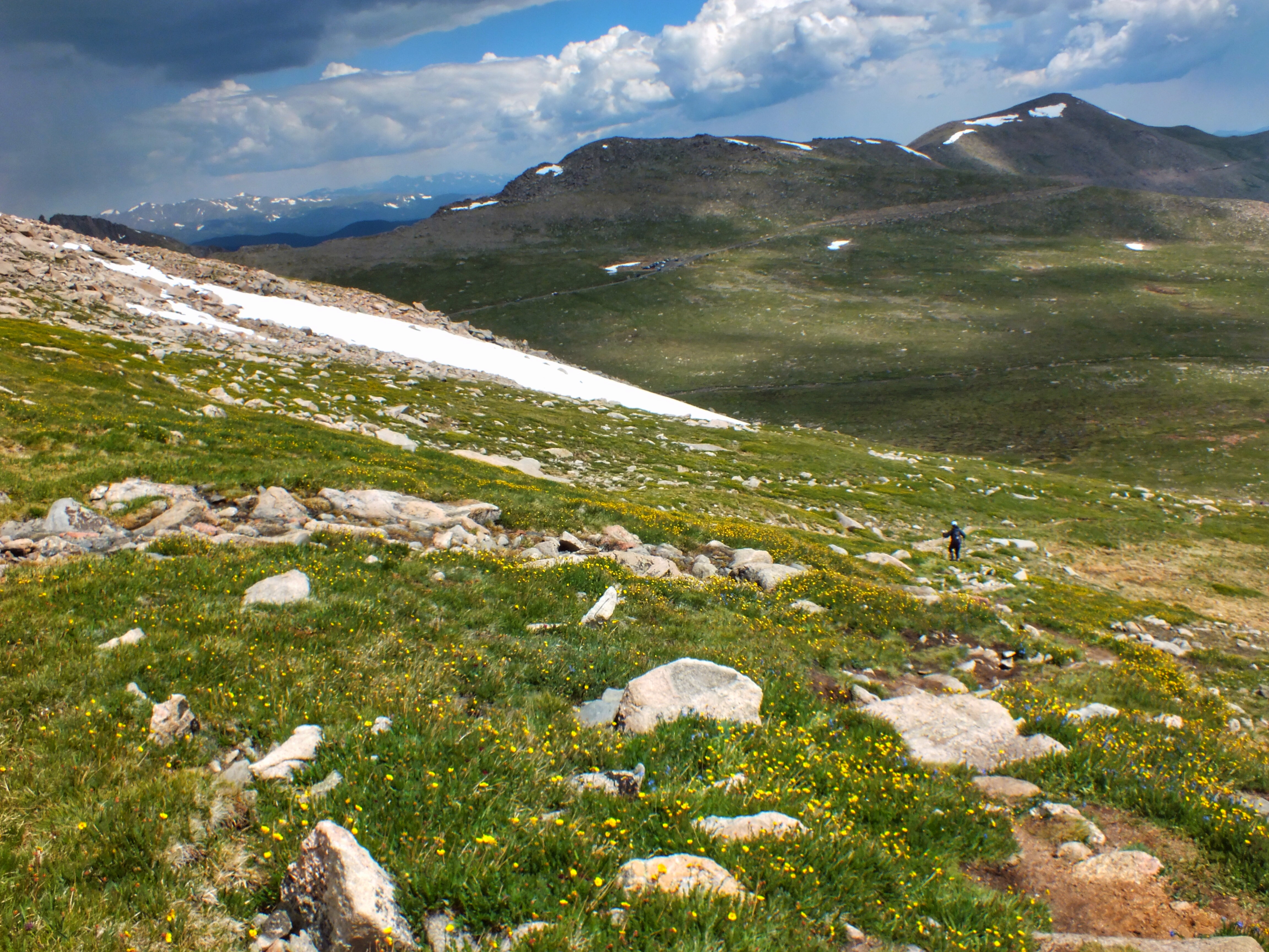
Looking back on Summit Lake and the parking lot. The main peak is at the top of that slope to the right.
Another view of Chicago Lakes from higher up.
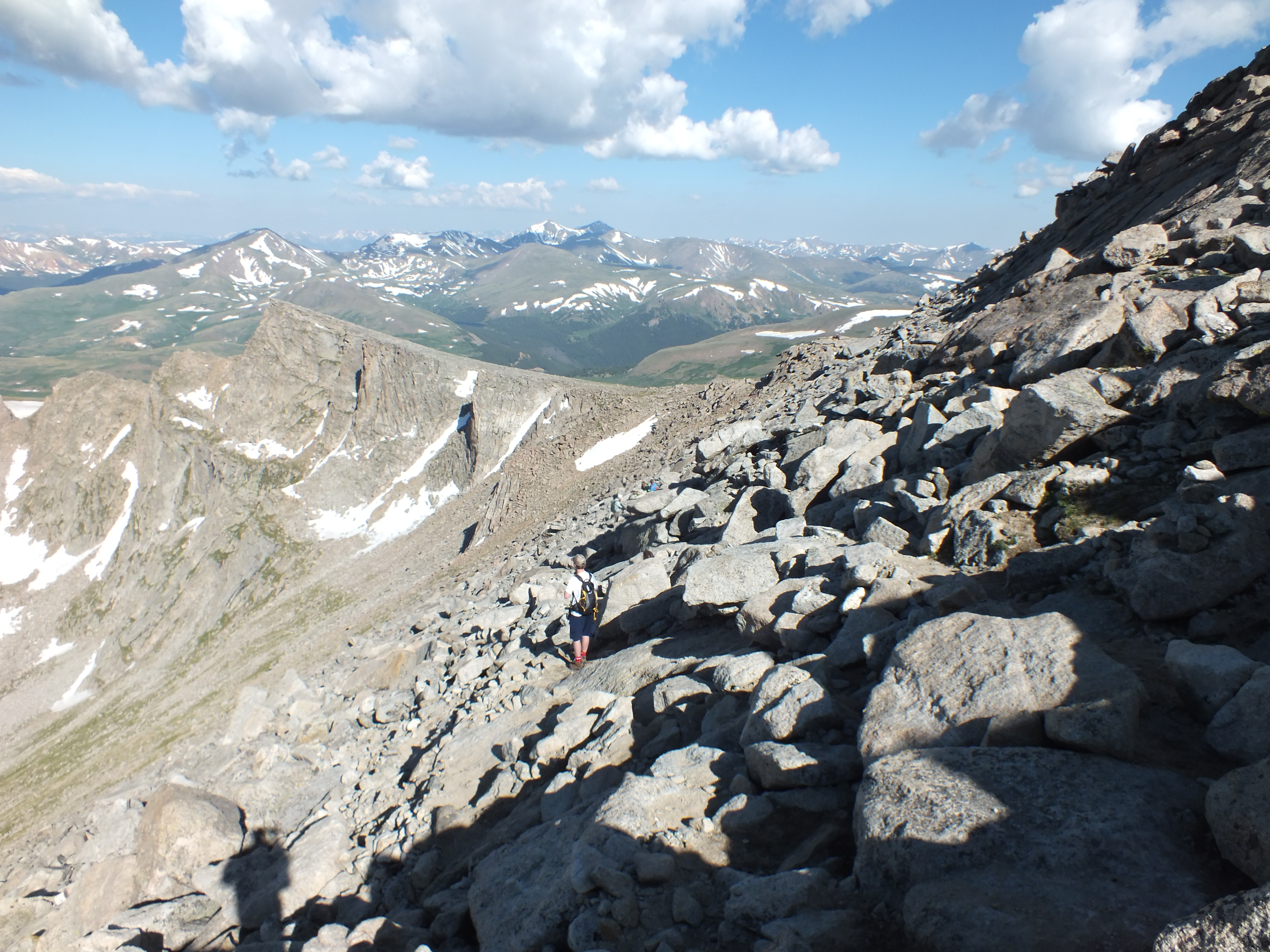
At the top of the first ridge. I was a little disturbed when I realized I had to lose a couple hundred feet of altitude to cross the saddle to the main ridge. I think that’s Mount Bierstadt on the right with the Sawtooth in front of it. Albert Bierstadt was a painter known for his romantic views of the Rocky Mountains. He originally gave Mount Evans the name Mount Rosa, in honor of the wife of another man (whom he later married). It was renamed to honor John Evans, the second governor of Colorado territory.


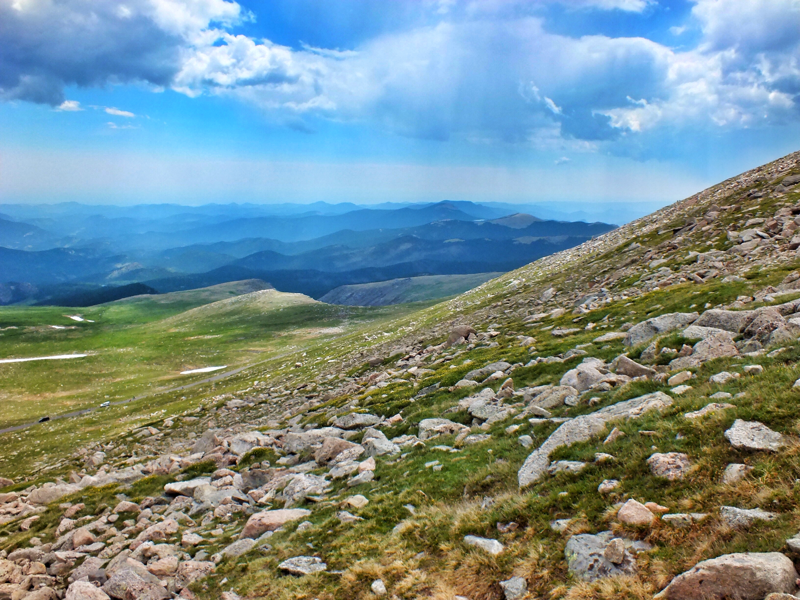
Looking back, with Mount Evans Scenic Byway crossing the hills in the middle distance.

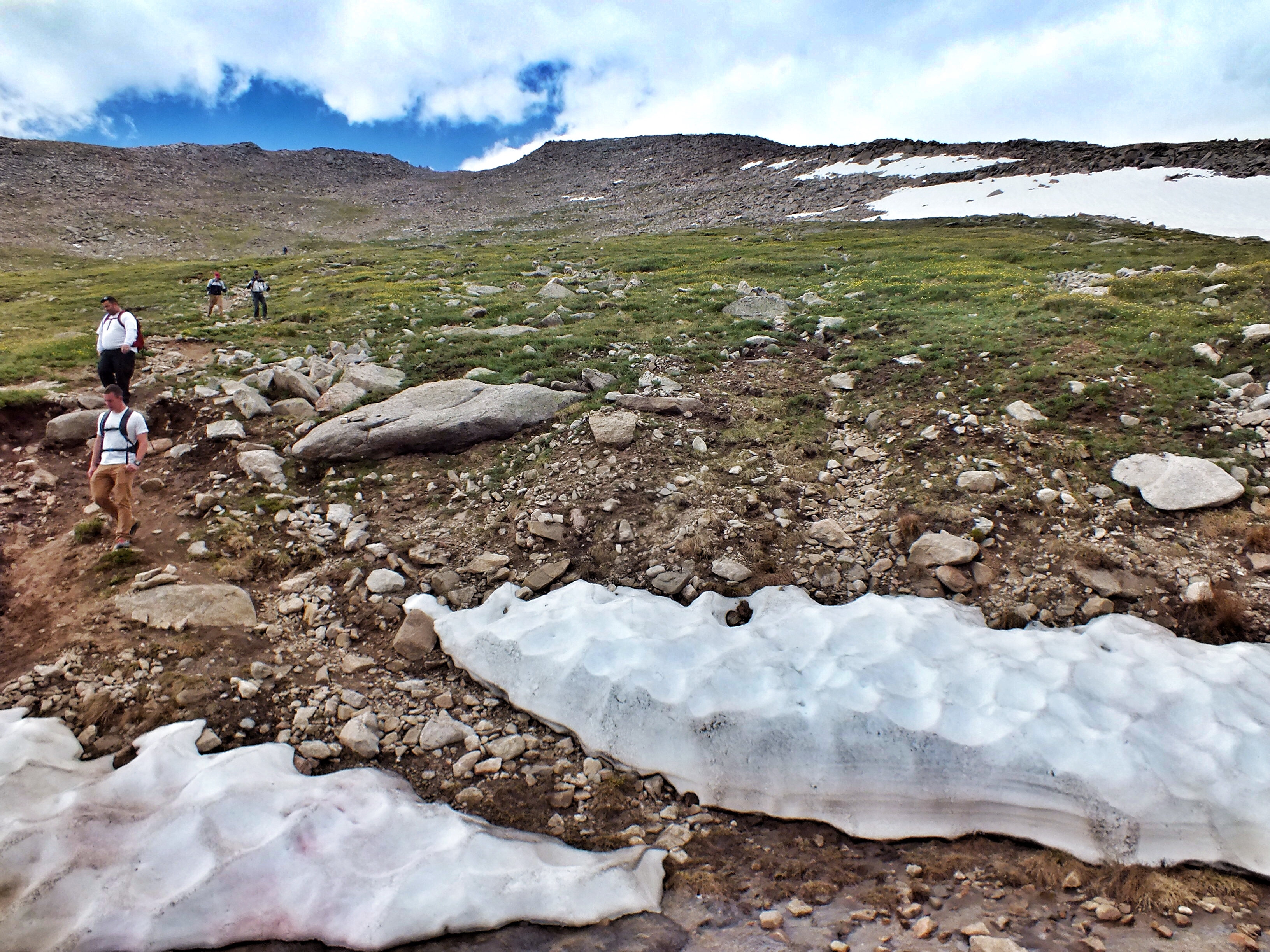
Two shots from in the saddle. I had just passed through a small snow field, the only one I had to deal with.


The view to the south from somewhere near the saddle. The haze may be from the Breckenridge fire.
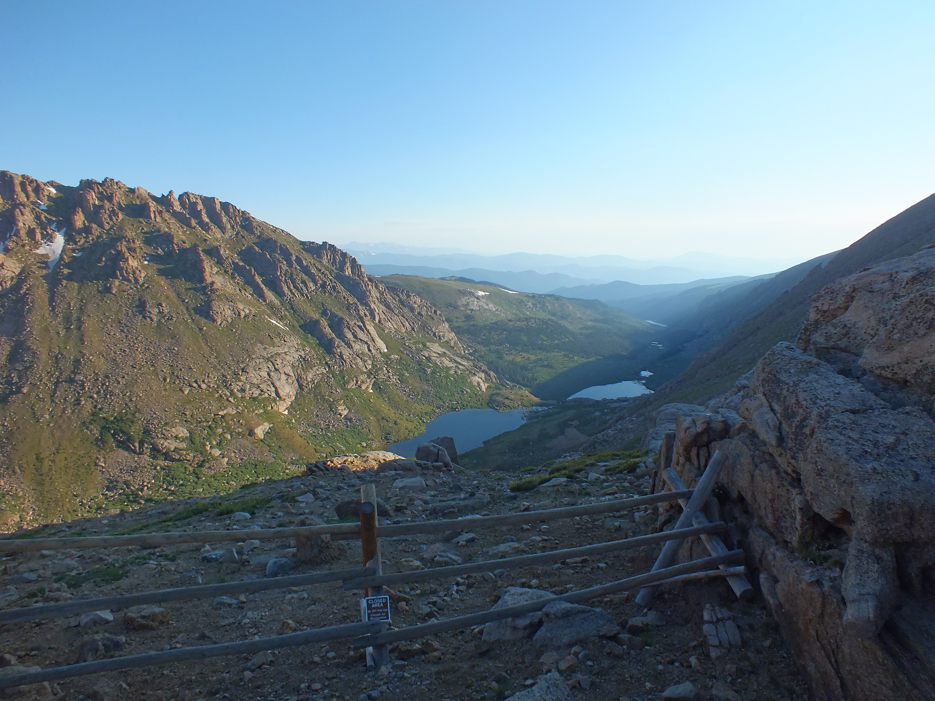
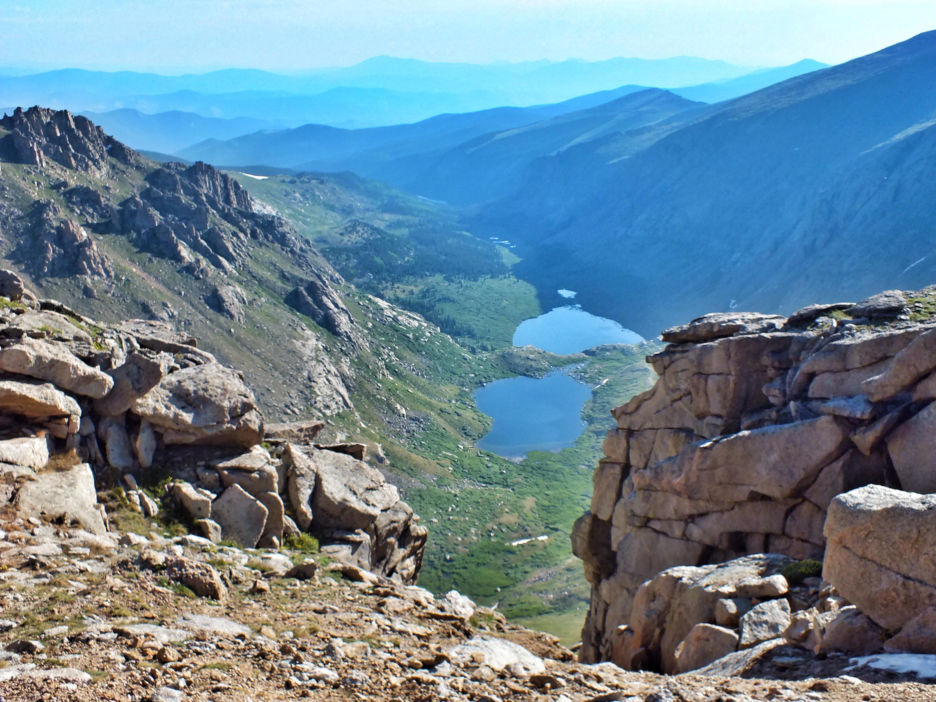
I think that’s Abyss Lake down in the valley. The Chicago Peaks have the deepest glacier tarns in the Rockies, and many of them contain lakes.
The west side of the main ridge was a huge boulder field. The trail was marked with cairns of rocks piled on top of boulders. Without these, there’s no way I could have followed the trail.

About this time, I spotted the two faster-hiking members of my group above me on the ridge. They had climbed a secondary peak and were returning to the trail. After a while, they caught up with me (of course) and kept pace with me for a half mile or so until I stopped to photograph a pair of Brown-capped Rosy-Finches (next post). Looking back the way I’d come.
Looking west toward Mount Bierstadt with Abyss Lake below.
I climbed up to the ridge and looked over for a view of Summit Lake and the parking lot.


Even though I’d come about two miles by this time and done a lot of climbing, I was feeling OK—except for the dizziness. If I just kept my eyes on my shoes and the trail immediately in front of me, I was OK. But as soon as I looked up, I got light-headed. There were more than a few times when I stumbled and I just managed to catch myself with my hiking poles or hands. I had to pretty much stop whenever I wanted to check out the view or the trail ahead. Then I had to endure five or ten seconds of dizziness before I regained my equilibrium and could look around. And even though I was making an effort to remember to drink water, I’m sure I didn’t drink enough. I ended the hike with half my three-liter backpack still full.
The trail I was on meets the trail from the parking lot about 250 feet below the summit. By the time I got there, I’d been climbing for two hours. Suddenly I was surrounded by people who’d been hiking for four minutes. The two who finished ahead of me were kind enough to pretend that the three of us were the first to summit, which technically, we were. But if they hadn’t climbed the other peak, they would have reached the top long before me.

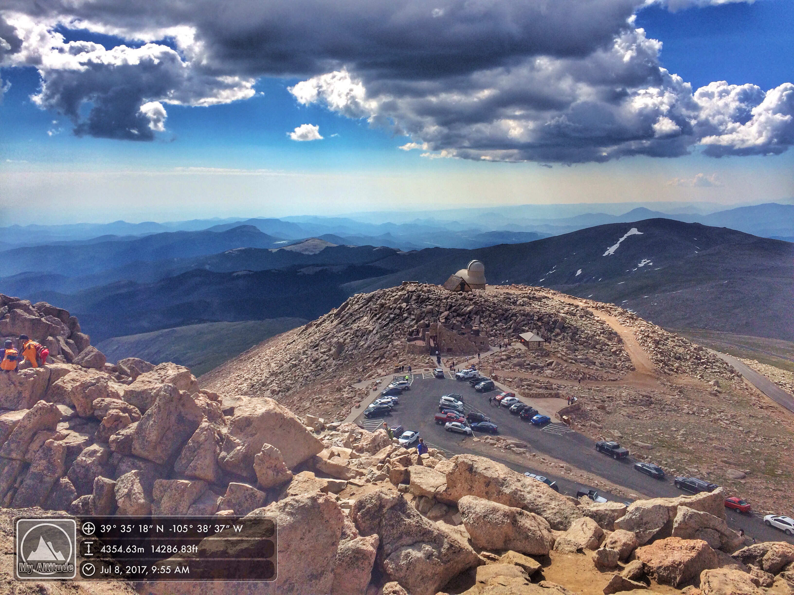
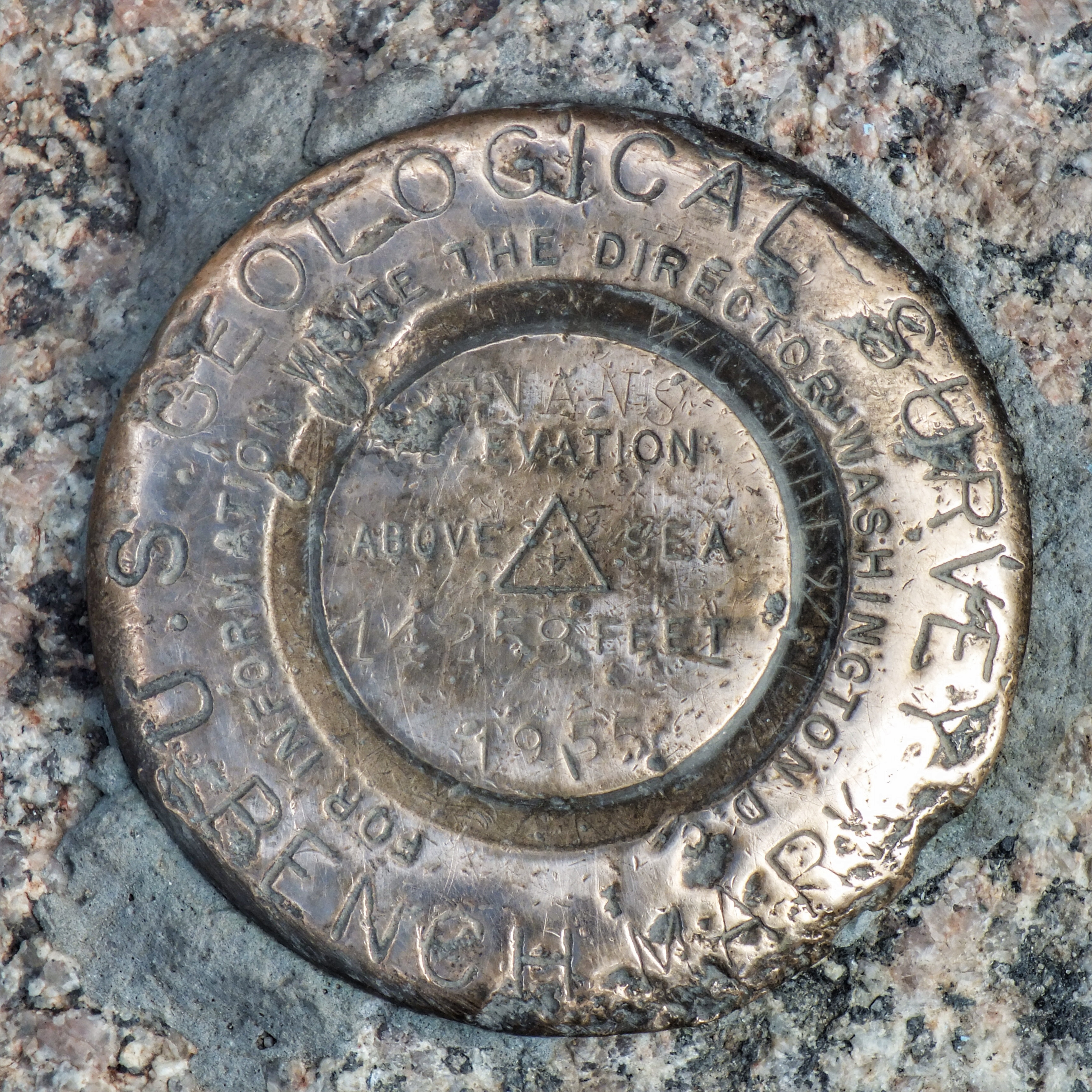
Beyond the parking lot there were three structures; an observatory, an A-frame built to investigate cosmic rays, and the ruins of a gift shop/restaurant that burnt down in 1979 and was never rebuilt.
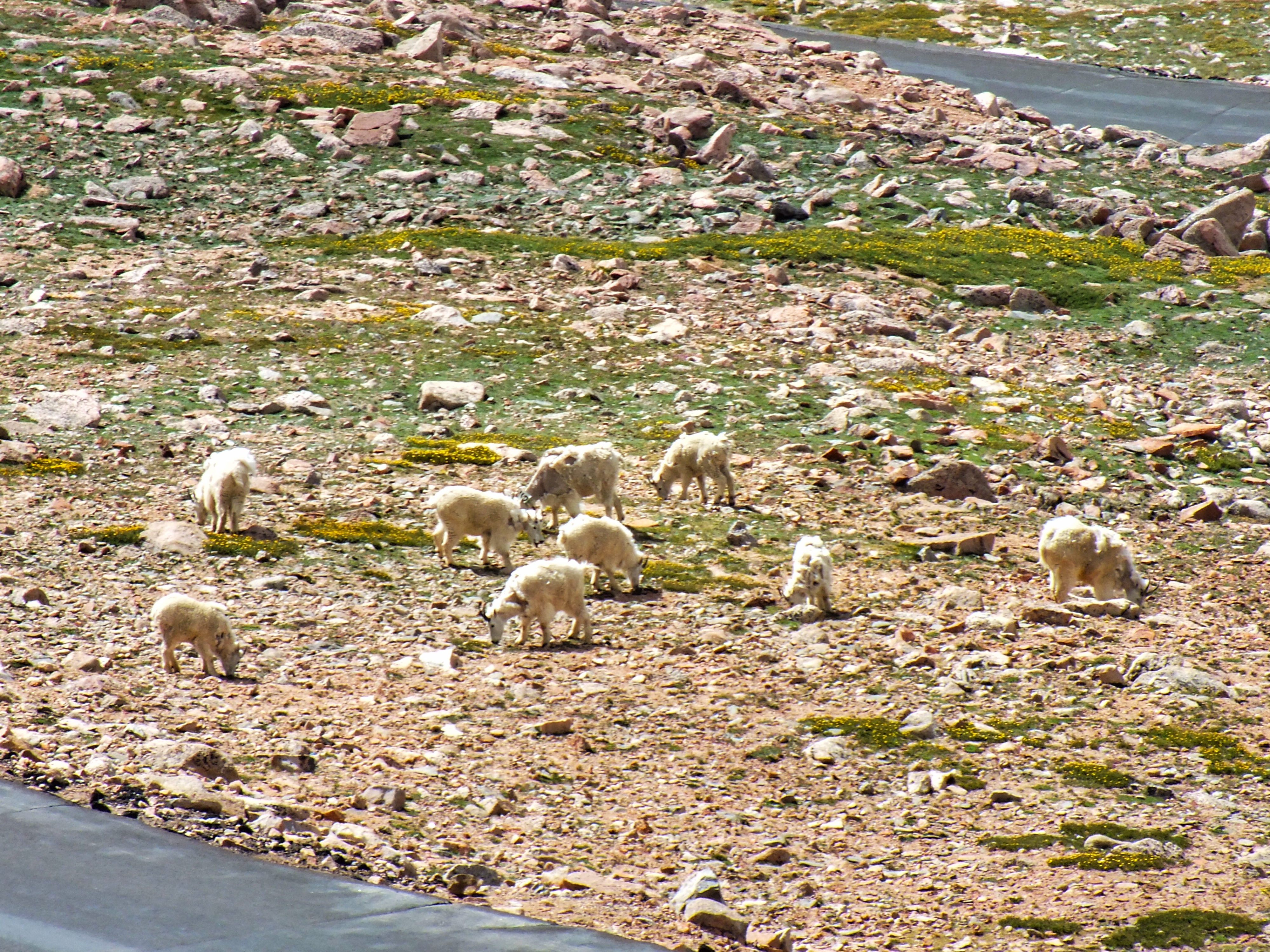
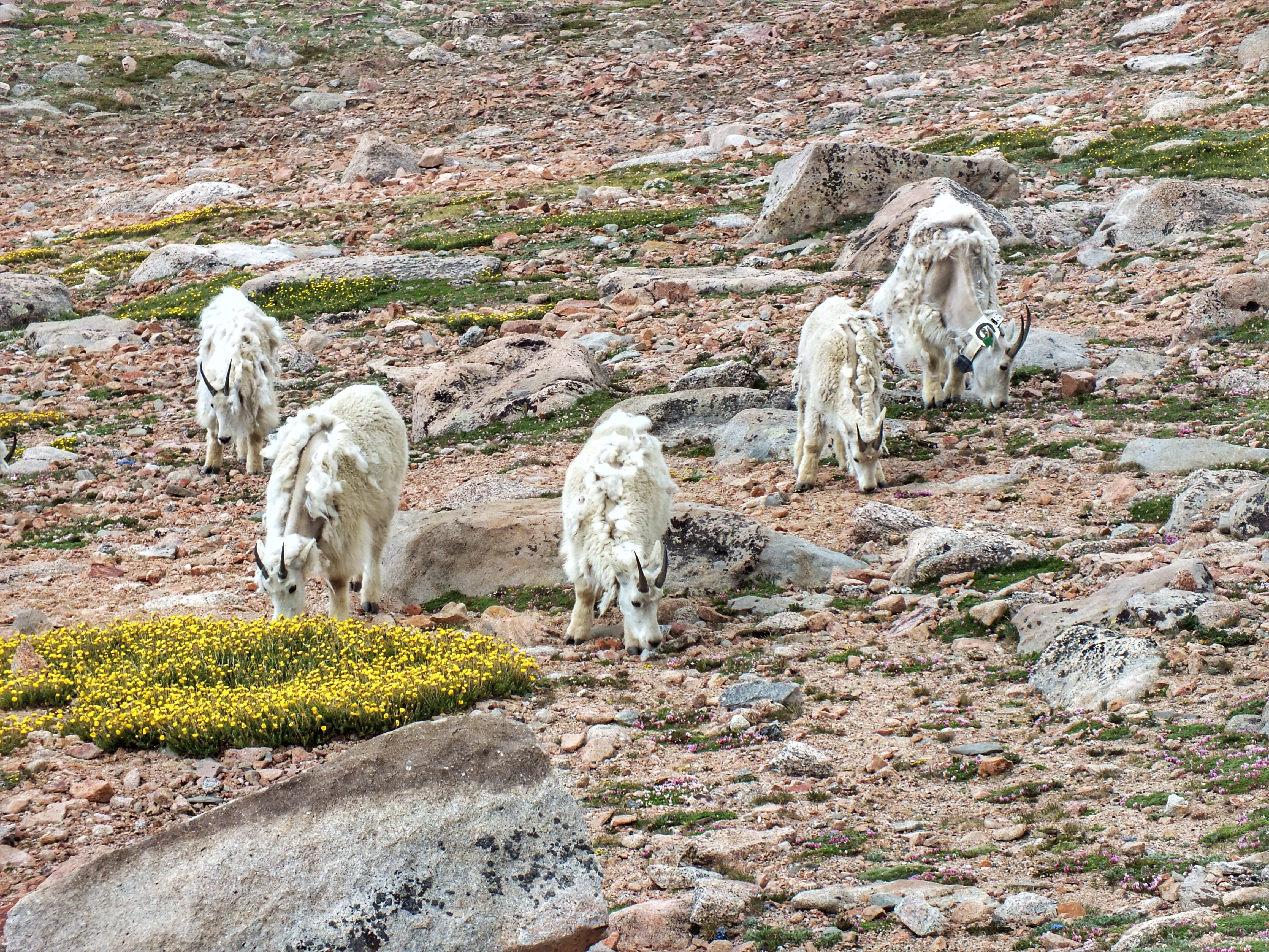
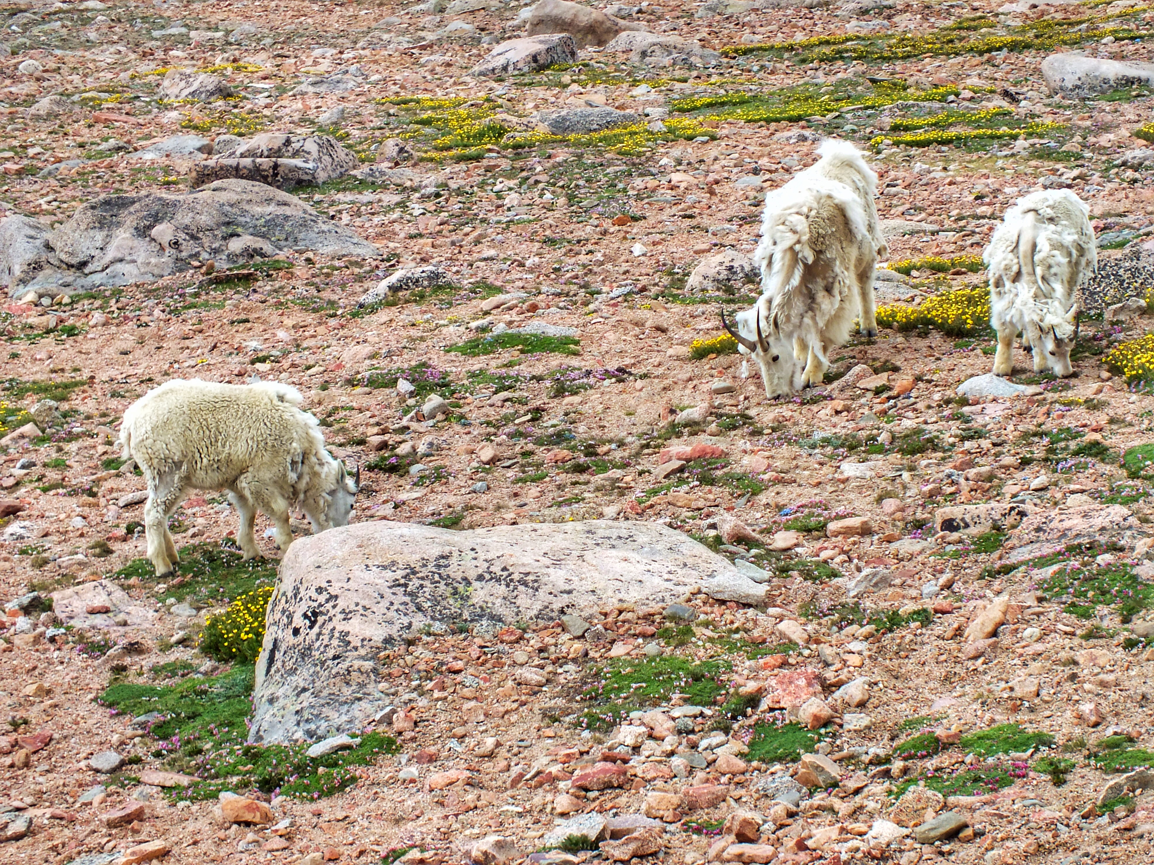
A herd of mountain goats were sleeping on the rocks at the end of the point.

While we were still on the summit, they ran down through the parking lot and began grazing in the flats along the road. They were shedding their winter coats and looked bedraggled.
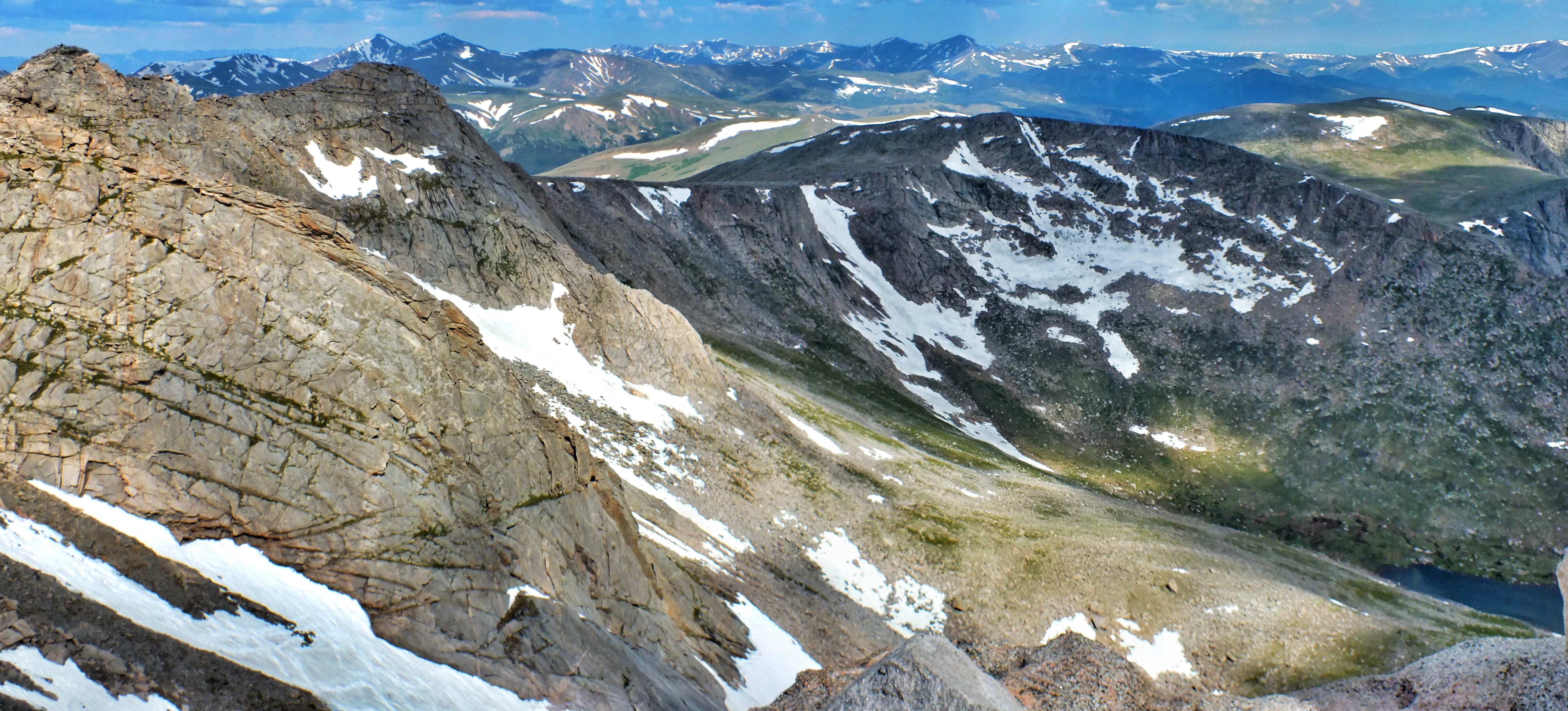
Other shots from the summit. In the first one, you can see the parking lot along Summit Lake.


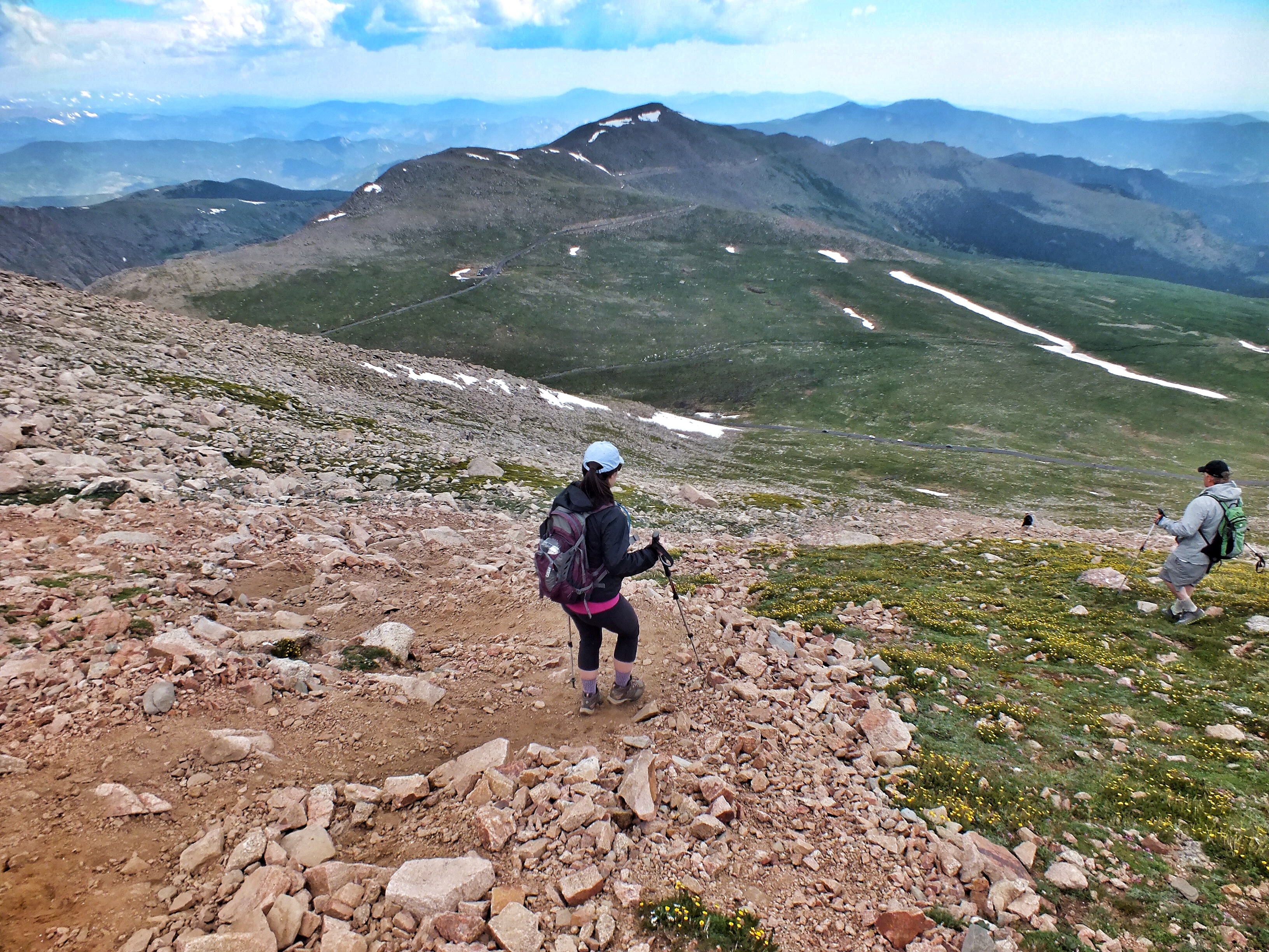
Dark clouds were forming by this time. It’s standard knowledge that you want to be off the 14ers by 11 or 12 because of storms. We decided to head down another, quicker way. It was snowing when we started—that weird puffy snow that looks and feels like bits of Styrofoam.
I wasn’t fond of this trail, It was a long, long stretch of scree that slid under my feet and was tough on my ankles and knees.

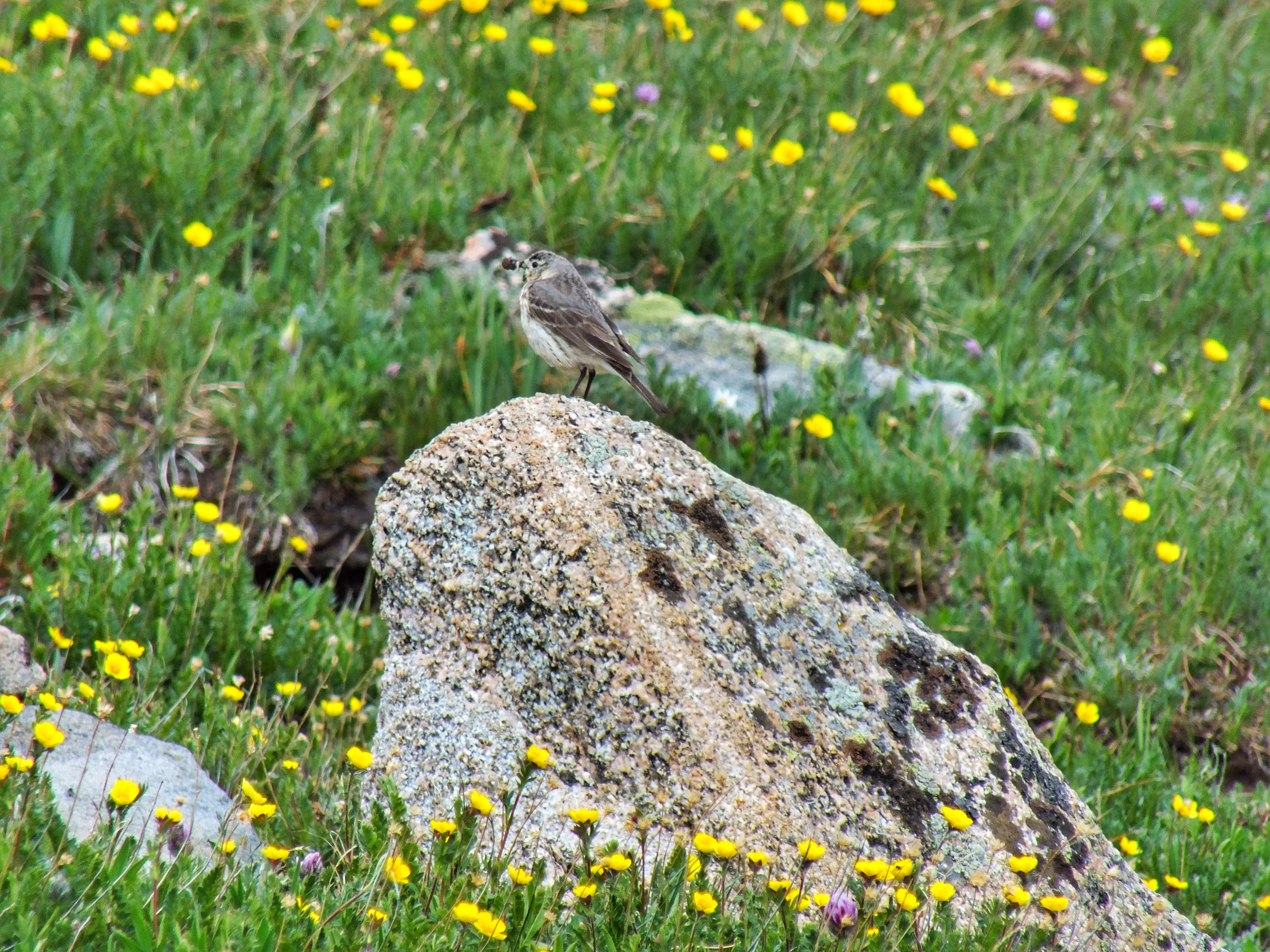
I kept my eyes open for White-tailed Ptarmigan, but they are so cryptically colored that you almost have to step on one to find one. I did spot a cooperative American Pipit. The bottom half of the trail had fewer rocks and better footing. The wildflowers here, and pretty much everywhere on the mountain, were amazing.
Here’s a shot back up the trail from the road.
It was still another half mile back along the road to the car. The road was packed in both directions with cars and bikers.
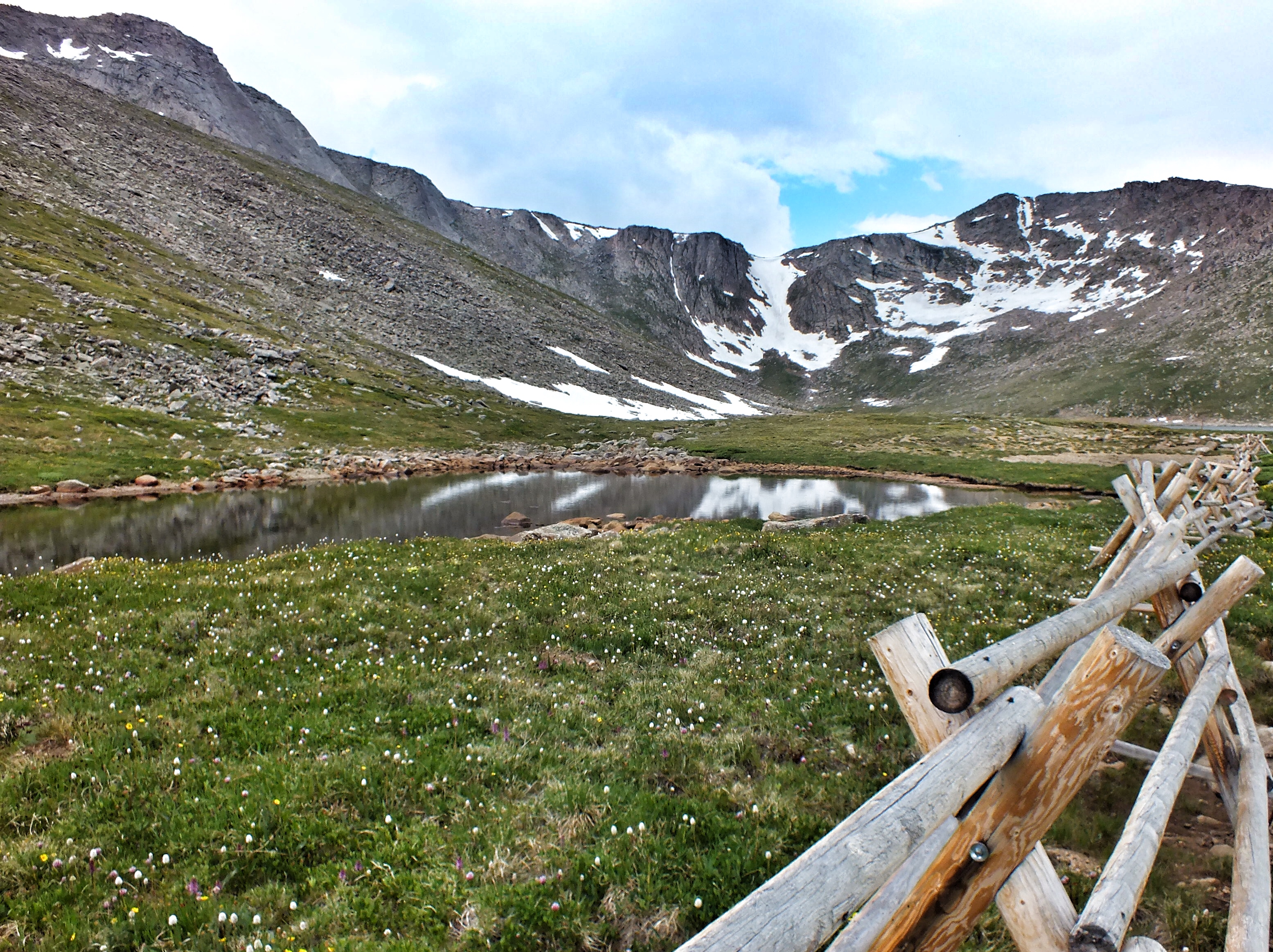
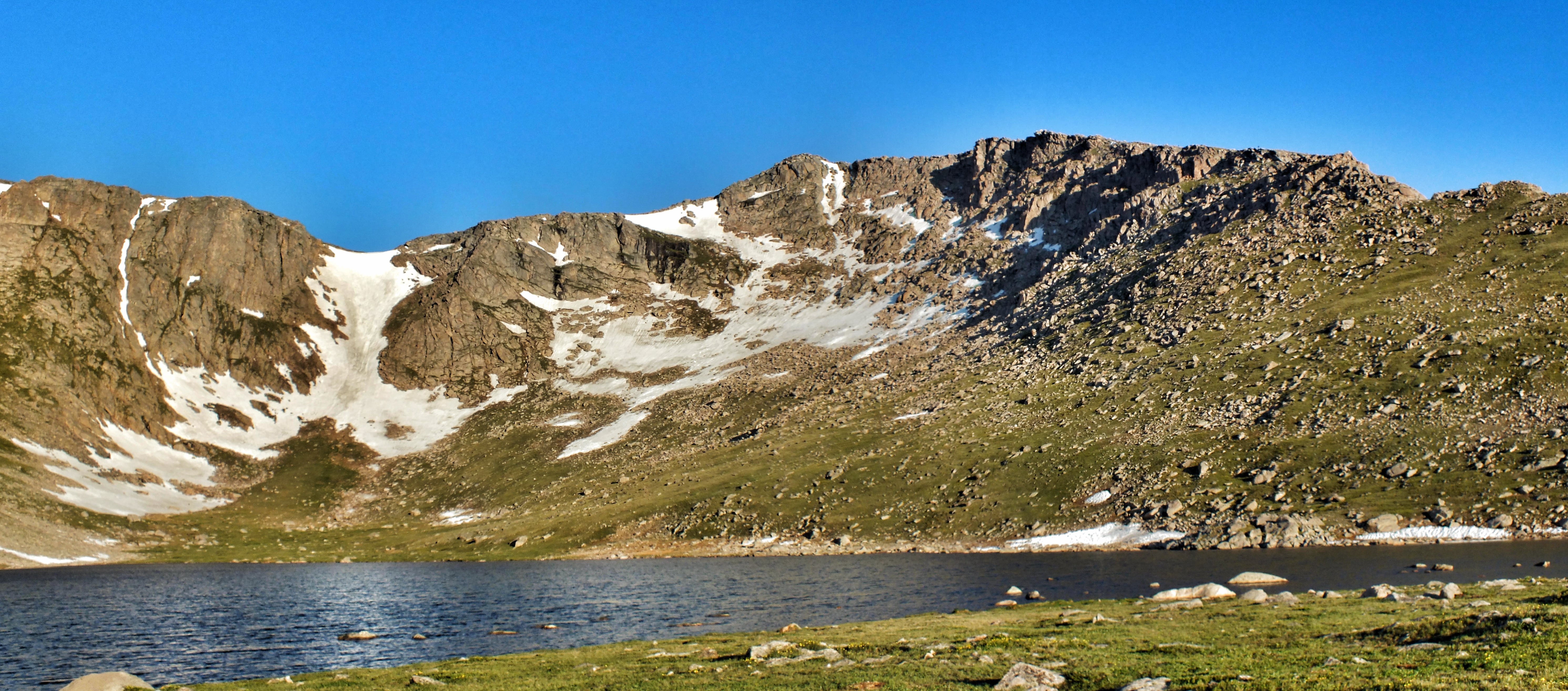
The tarn around Summit Lake is considered the southernmost alpine tundra in North America because the ground is saturated with water and there’s a layer of permafrost underneath.
At the time, the climb seemed like a lot of work, but in retrospect, it was fun, and the beauty was worth the effort.
Very cool.